01.03.2022 – 31.03.2025
€ 853,141
Klaus-Holger KNORR
kh.knorr@uni-muenster.de
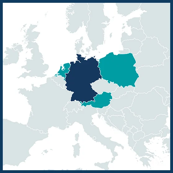
Coordinator: Landscape Ecology, University of Münster, Münster, Germany
Geography and Regional Research, University of Vienna, Vienna, Austria
Aquatic Ecology, Radboud University Nijmegen, Nijmegen, Netherlands
Climate Change Ecology, Adam Mickiewicz University, Poznań, Poland

The regulatory functions of peatlands in water and element cycles, their carbon sink function, and their role in biodiversity conservation have increasingly become the focus of scientific and public debate. Particularly in the course of ongoing climate change, ombrotrophic peatlands (bogs), pristine, disturbed or under restoration, are increasingly exposed to climate extremes, such as drought, with long-lasting effects on both plant and soil communities and, subsequently, on carbon cycling. Thus, climate change adds to existing difficulties and limitations in bog restoration. These problems are also related to poor knowledge of potential indicators of peatland degradation or of restoration success, such as on the dynamics and budgets of gas fluxes, levels of biodiversity, or water budgets. Moreover, peat degradation alters the water holding capacities and reduces the potential to buffer variations in water availability, further constraining rewetting and restoration. ReVersal aims at bringing together key methods from different peatland-related disciplines to address these research deficiencies, namely from palaeoecology, hydrology, biogeochemistry, greenhouse gas exchange and carbon budgeting, vegetation ecology and biodiversity, and remote sensing.
ReVersal will evaluate degraded and restored sites and include:
- Palaeoecological data to understand past succession and hydrology over periods of past changing climate and land-use
- Indicators of peat decomposition and current hydrological and nutritional status
- Indices of biodiversity in vegetation and microbial communities
- Aim to provide robust estimates of the carbon and greenhouse gas budgets.
This evaluation will be complemented by the latest remote sensing techniques as prospective tools to assess and monitor peatland restoration sites. In the intended approach, patterns and processes behind indicators are assumed to feature complexity and nonlinearity requiring a data-driven approach and machine-learning strategies to derive patterns from field-based data that can be transferred across peatland sites. ReVersal postulates that indicators of peatland status as outlined above can be mapped in space and time using multi-scale and multi-sensor remote sensing data, hence allowing for continuous monitoring of degraded or restored peatlands. Approaches, indicators, and results will be discussed and evaluated with local stakeholders at all sites under study. This will include among others nature conservationists, farmers, water bodies, authorities, national wetland conservation centres, and the European Competence Centre for Mires and Climate in Wagenfeld (Germany).
ReVersal examines and evaluates, for the first time, bog restoration pathways based on a state-of-the art evaluation of paleoecological and biogeochemical information from peat samples, putting this data into a landscape ecology context, and delivering powerful remote sensing tools for future assessment and monitoring of degraded and restored peat bogs. To this end, biological and biogeochemical conditions, and fluxes of CO2 and CH4 will be examined to mechanistically understand carbon budgets and effects of water and nutrient availability. Changes in biodiversity along degradation and restoration trajectories under past, current and future climatic and socio-economic conditions will also be explored. Additionally, uncertainties of conservation and restoration approaches will be evaluated for adaptive management strategies including trade-offs between goals and remote-sensing based models to assess degradation indicators in space and time to facilitate knowledge integration and transfer will be developed. Another activity will consist in assessing the transferability of these models across landscapes to provide cost‐effective, reliable and long-term monitoring prospects.
The main objective of ReVersal is to develop a spatiotemporally explicit indicator framework for peatland restoration success across peatland sites affected by drainage and/or extraction. The gathered knowledge will be communicated and create outreach in close collaboration with farmers, the peat industry, nature conservationists, water managers, and administrative bodies. We expect that the knowledge and tools developed in ReVersal will help to assess the current status and monitor the restoration of ombrotrophic peatlands in a multidisciplinary approach and on a scientific basis.
ReVersal will work at seven degraded or restored peatland sites, spanning a gradient of different water and nutrient availability and situated in locations that are to a varying degree affected by the observed increasing frequency of droughts in Europe. These sites are located in Austria (Pürgschachen Moor, Pichlmeier Moor), Germany (Amtsvenn, Vechtaer Moor), Poland (Bagno Kusowo), Sweden (Store Mosse), and in The Netherlands (Fochteloër Veen). Additional sites will be included for the application and testing of the remote sensing approaches.
- Deutsche Forschungsgemeinschaft (DFG), Germany
- Austrian Science Fund (FWF), Austria
- Ministry of Agriculture, Nature and Food Quality (LNV), Netherlands
- National Science Centre (NCN), Poland