Continuing our series of webinars dedicated to novel technologies for biodiversity monitoring across Europe, this webinar explored the ways remote sensing can support biodiversity monitoring and data collection at different scales. Speakers highlighted recent advances in remote sensing and presented early results from the Biodiversa+ Habitat pilot, which compares remote-sensing techniques transnationally among participating European countries.
Some takeaways:
- Maria J. Santos (University of Zurich, Switzerland) presented the rapid evolution of remote sensing for biodiversity, moving from basic vegetation indices to a wide range of sensors – optical, LiDAR, SAR… An emphasis on imaging spectroscopy data that allow measuring plant traits, determine species composition and physiology, assess phenology, and understand ecosystem processes. She highlighted several advances, notably in the use of imaging spectroscopy to determine foliar chemistry, detecting and assessing species populations of e.g. invasive species, and linking spectral signatures to genetic diversity in tree species. She noted key challenges: limited field data, the need for better uncertainty assessment and the importance of more causal ecological approaches so that our understanding of biodiversity change and processes can continue to grow.
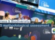
- Sara Wiman (Swedish Environmental Protection Agency, Sweden) detailed the Biodiversa+ Habitat pilot, aimed at assessing how remote sensing can support harmonized monitoring of habitat condition across Europe. She showed how inundation patterns, vegetation states and seasonal dynamics can be captured, and how super-resolution can reduce mixed pixels but may introduce artifacts. She also outlined major challenges, such as cloud cover, gaps in satellite data and inconsistent field validation. She presented a shared interpretation tool developed to harmonize assessments among participating countries.